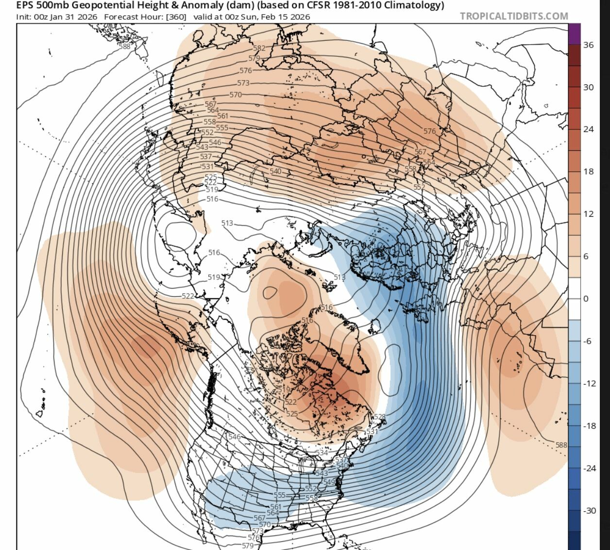
De kans groeit dat het medio februari voorbij is
Bericht van: sebastiaan (bussum) , 31-01-2026 11:31Ik bedoel dan de winterse perikelen. Groenlandhoog is te zwak. Depressies voeren op onze breedtegraad of wat noordelijker.
Het heeft te maken dat vanuit de Pacific geen impuls meer is. En daarbij SSW (of verzwakking strat. poolwervel) geen significante downwelling krijgt.
We wachten rustig af.
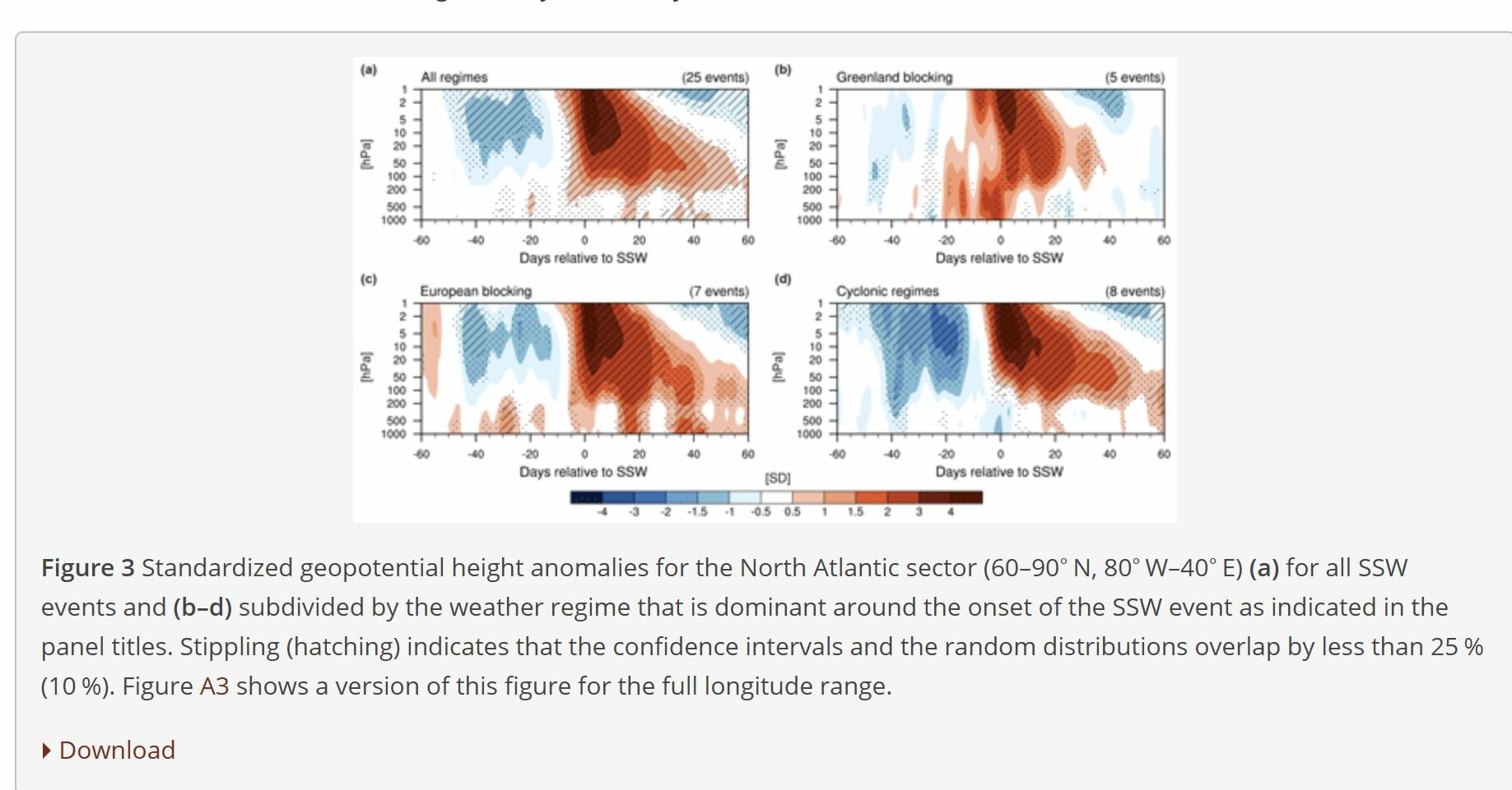
"SSW events that occur during Greenland Blocking (Fig. 3b) are associated with an immediate, strongly positive anomaly in the troposphere. Consistent with Fig. A2b, when Greenland Blocking is present around the onset of the SSW, Greenland Blocking or Atlantic Ridge are often already present before the SSW event, which is likely the cause of the positive tropospheric geopotential height anomalies several days prior to the event. Notably, there are no significant and robust (Figs. 3b and A4b) anomalies after 10 d of the onset of the SSW except for a weak negative geopotential height anomaly after 20 d (significant at the 25 % level), indicating a cyclonic flow regime in the North Atlantic/Europe region. This is consistent with the significantly enhanced likelihood for the occurrence of the Atlantic Trough regime at this lag (Fig. A2b). Note that both the immediate positive geopotential height anomalies and the weak tropospheric anomalies in the aftermath of the event are not the result of cancellations in the composites but are rather typical across cases. In fact, four out of the here identified five Greenland Blocking events have been classified by Karpechko et al. (2017) as having no downward impact."