Vanavond vooral in Noord NL kans op een paar onweersklappen.
Bericht van: Bas C. (Oostvoorne) , 20-01-2006 16:41
ESTOFEX geeft zelfs een zeer kleine kans op wind- of waterhozen.
KNMI Guidance modelbeoordeling:
Estofex:
KNMI Guidance modelbeoordeling:
Geldig tot zondag 22 januari 2006, 00 UTC.
Opgesteld door het KNMI op vrijdag 20 januari 2006 om 12.06 uur.
MODELLEN BEOORDELING:
Koufront in de analyse van HiR-06 loopt nog steeds achter bij de
werkelijk positie (actueel is het KF zo'n 2 uur sneller). EC00 en UKRM06
doen dat een stuk beter. V.w.b. de modelevolutie blijft het
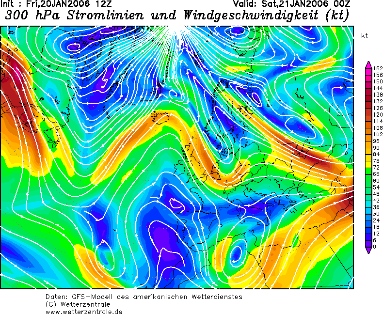
timingsverschil bestaan. Dat geldt ook voor de trog die na KF-passage
volgt. Deze is in de nieuwe run nu ook terug te vinden (oude run
vertoonde een flauw rimpeltje in het isobarenpatroon). De trog is ook op
hoogte te traceren als een gesloten gebied met lage temperaturen op 500
hPa (< -35C).
Zaterdagavond trekt een back-bent occlusie van het lage drukgebied, dat
via Zuid-Scandinavie zuidoostwaarts trekt, het NO van het land binnen.
Daarachter bevindt zich continentaal polaire lucht. Bij deze backbent
zou (in het NO) wat lichte sneeuw kunnen vallen. Progtemps en NESO
Uitvoer (nieuwe run geeft alleen natte sneeuw / 00-run ook indicatie
droge sneeuw) geven dat weer.
AANDACHTSPUNTEN:
Neerslag: Bij buien is in de nacht van vrijdag op zaterdag hagel en ook
een klap onweer mogelijk. Toppen tot FL200. In de nacht van zaterdag op
zondag in het noordoosten kans op wat lichte sneeuw. Kleine
hoeveelheden.
Estofex:
...Netherlands , N-Germany and western Denmark...
Active cold front will reach the coastal areas of Netherlands and NW Germany during the afternoon hours... Instability should be nearly zero, but don't want to exlcude and isolated short-lived TSTM with gutsy winds.
Postfrontal airmass looks more promising for TSTM development, when cold mid-level airmass arrives during the evening hours... Accompanying trough axis should yield enough forcing for isolated TSTM development, mainly along the coastal areas of NW Germany...LL shear up to 15m/s favors a risk for an isolated severe wind gust/ waterspout or tornado report, but instability too marginal for a more significant threat.
Also included western Denmark, because of an augmented waterspout risk, when core of upper-level system crosses the region, but window of best conditions looks like to be only very brief.
Bericht laatst bijgewerkt: 20-01-2006 16:43