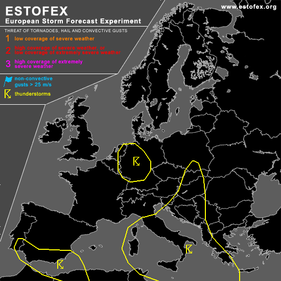
STORM FORECAST
VALID Sat 29 Apr 06:00 - Sun 30 Apr 06:00 2006 (UTC)
ISSUED: 28 Apr 17:22 (UTC)
FORECASTER: DAHL
SYNOPSIS
Southward moving ... intense upper cut-off low over N-central Europe is progged to stall ... and become settled over central Europe. Broad southern frontal zone ... exhibiting several vort maxima ... is stretching across the south-central and E Mediterranean Sea. At low levels ... plume of relatively warm/moist air is present E of the central European upper low ... while polar air is advancing southward across W Europe W of the upper low ... with a narrow plume of this air mass spreading into the central Mediterranean through the Rhone valley.
DISCUSSION
...Germany...
Scattered TSTMS should develop with diabatic SFC heating beneath the upper thermal low primarily over Germany ... Shear profiles should be rather weak ... as should be the CAPE ... and organized severe TSTM threat should be low.
...central Mediterranean...
It seems that bulk of activity will occur just outside the favorably-sheared regions ... and given nearly neutral thermodynamic profiles ... organized severe threat should be quite low.