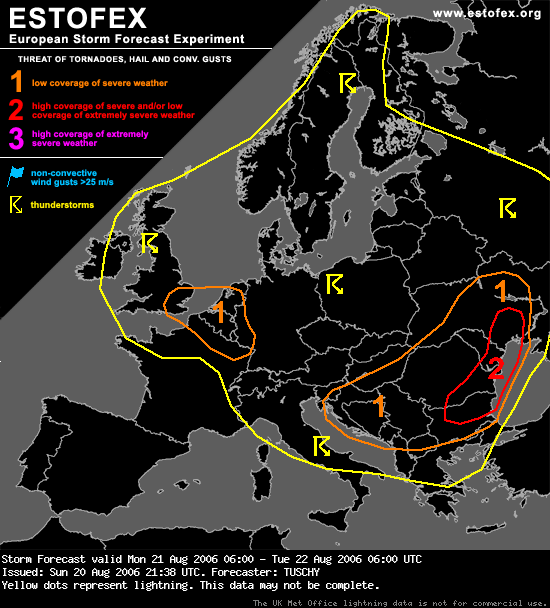
... Belgium, the Netherlands and extreme western part of Germany...
GFS seems to has a good handling with a small disturbance, crossing United Kingdom during the early morning hours, arriving a few hours later in the area of interest.... WV and IR loops ( 20.08. at 20Z ) already show a well developed disturbance, indicating signs of slowly increasing convective activity.... Wind profiler datas of Uist also indicate the approaching disturbance and its well developed circulation pattern.
A pool of cold mid-level air ( ~ -20°C at 500hPa ) will cross the eastern English Channel ( with SST`s of 18-19°C ) with anticipated instability release of ~500 J/kg mainly over Belgium and the Netherlands.
Although DLS will be very weak, a combination of enhanced LL shear / SRH-1km values and a uncapped boundary layer in the level-1 area will pose a risk for isolated tornado / cold-core funnel development.
Models inidcate rapid decrease of instability further inland.... LCL's of ~ 500m and steepening mid-level lapse rates in a nearly uncapped environment under the base of this disturbance should be enough for at least low-end instability release till southern Germany....
Late arrival, weak instability signals and strengthening stable boundary layer preclude a level-1 over parts of S-Germany for the moment.