Benelux
A surface low is expected to develop over France/southwestern Germany during the day, providing warm air advection over Benelux. Given steep mid-level lapse rates and rather rich moisture in low-levels, instability will likely realize. However, do not see that dewpoints will reach around 20°C as indicated by latest GFS model run. Additionally, low-level air mass may be relatively cool. Expect that thunderstorms will form during the afternoon/evening hours that may be elevated over some places. Given increasing north-easterly surface winds and therefore increasing vertical wind shear, chance for organized convection will be increased, too. A few multicells are forecast to develop, while only low chance for large hail is expected. Thunderstorms may go on well into the night in the warm air advection regime.
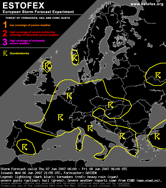
Toch wel logisch, want de kans op randverschijnselen is miniem. En daar gaat het Estofex voornamelijk om.
A surface low is expected to develop over France/southwestern Germany during the day, providing warm air advection over Benelux. Given steep mid-level lapse rates and rather rich moisture in low-levels, instability will likely realize. However, do not see that dewpoints will reach around 20°C as indicated by latest GFS model run. Additionally, low-level air mass may be relatively cool. Expect that thunderstorms will form during the afternoon/evening hours that may be elevated over some places. Given increasing north-easterly surface winds and therefore increasing vertical wind shear, chance for organized convection will be increased, too. A few multicells are forecast to develop, while only low chance for large hail is expected. Thunderstorms may go on well into the night in the warm air advection regime.
Toch wel logisch, want de kans op randverschijnselen is miniem. En daar gaat het Estofex voornamelijk om.