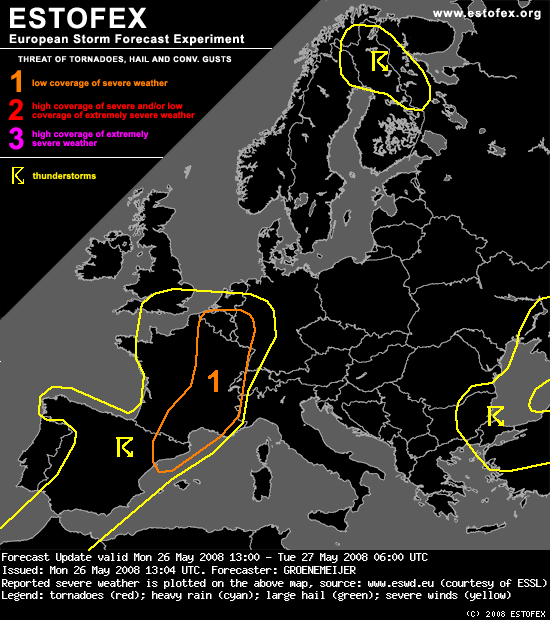
,,Visible satellite imagery shows towering cumulus developing across Belgium and the French région Nord. There and later elsewhere, isolated storms are expected to form. Up to 1000 J/kg of CAPE would be available to those storms, that develop in an environment of rather strong deep-layer wind shear of 20-30 m/s and high storm-relative helicity. As a result, they may develop into supercells capable of producing some large hail, and strong winds. Tornadoes are not ruled out either. A preferred location maybe the warm front across Belgium that extends into the German Rhineland.''
Gr. Ben
Gr. Ben