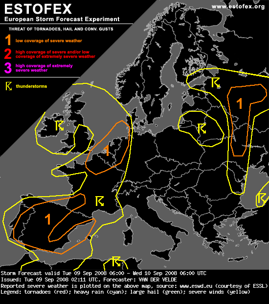
...N France, Belgium, Netherlands, W Germany, W Denmark...
From 06Z to 15Z, only marginal, spotty instability release is anticipated by GFS (shallow uncapped parcel layer depth) in the northwestern half of France and the Channel/southern North Sea region. Only after 18Z, and in the current GFS 18Z run around 21Z, significant deep convergence and CAPE release will be possible from a deeper layer elongated region from north-central France into the North Sea. Most quasigeostrophic lifting occurs over the Channel and UK.
CAPE itself will be nothing special, but the environment of 20 m/s 0-6 km shear vector length, >10 m/s 0-1 km shear and some 100-200 m2/s2 SREH over 0-3 km allow multicells transforming into an MCS, probably a (squall) line, as there is a 10 m/s 0-2 km shear component normal to the moisture axis.
The MCS may reach maturity after 00Z/03Z and pose a severe gusts threat (although higher LCL heights would be more favorable, but there is a rather strong steering flow). Rotating updrafts may initially be possible with some isolated large hail, and a brief tornado cannot be excluded on the basis of sufficient low level shear and very low LCL heights.
Note that in case of a squall line it may eventually go faster east/northeastwards than indicated by a large scale model like GFS