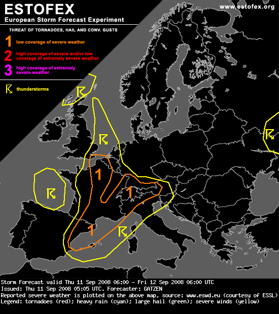
France, Benelux, Alpine region
An unstable air mass has formed over France and Alpine region due to advection of steeper lapse rates from the south and slightly increasing low-level moisture. During the afternoon, a weak mid-level trough now over southern France moves eastward associated with height falls. Given strong low-level heating during the day, thunderstorms will likely develop in the afternoon and evening hours over the Alpine region as well as ahead of the approaching cold front over France. Although deep vertical wind shear is not strong, initial convection may be quite intense, and large hail is not ruled out. To the north, low-level vertical wind shear will increase over the Benelux region, where low-level winds will likely turn to the east, and a tornado is not ruled out in the evening hours. Local flash flooding is another hazard given slow moving storms in the evening and night hours.
An unstable air mass has formed over France and Alpine region due to advection of steeper lapse rates from the south and slightly increasing low-level moisture. During the afternoon, a weak mid-level trough now over southern France moves eastward associated with height falls. Given strong low-level heating during the day, thunderstorms will likely develop in the afternoon and evening hours over the Alpine region as well as ahead of the approaching cold front over France. Although deep vertical wind shear is not strong, initial convection may be quite intense, and large hail is not ruled out. To the north, low-level vertical wind shear will increase over the Benelux region, where low-level winds will likely turn to the east, and a tornado is not ruled out in the evening hours. Local flash flooding is another hazard given slow moving storms in the evening and night hours.