Measurements from ESA’s CryoSat mission have been used to map the height of the huge ice sheets that blanket Greenland and Antarctica and show how they are changing. New results reveal combined ice volume loss at an unprecedented rate of 500 cubic kilometres a year.
...
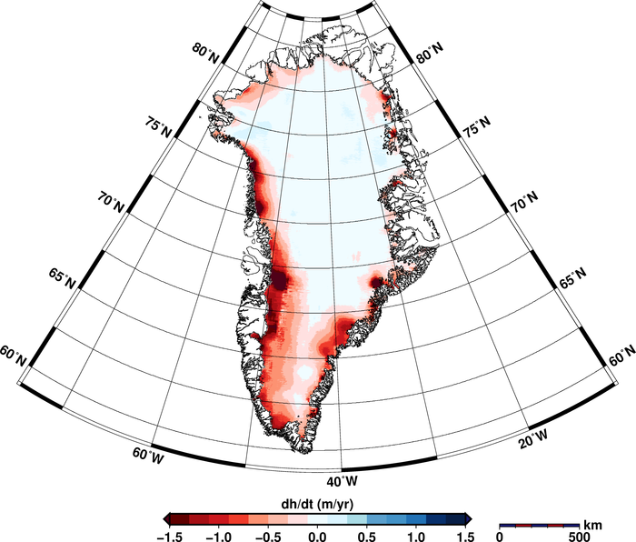
The resulting maps reveal that Greenland alone is reducing in volume by about 375 cubic kilometres a year.
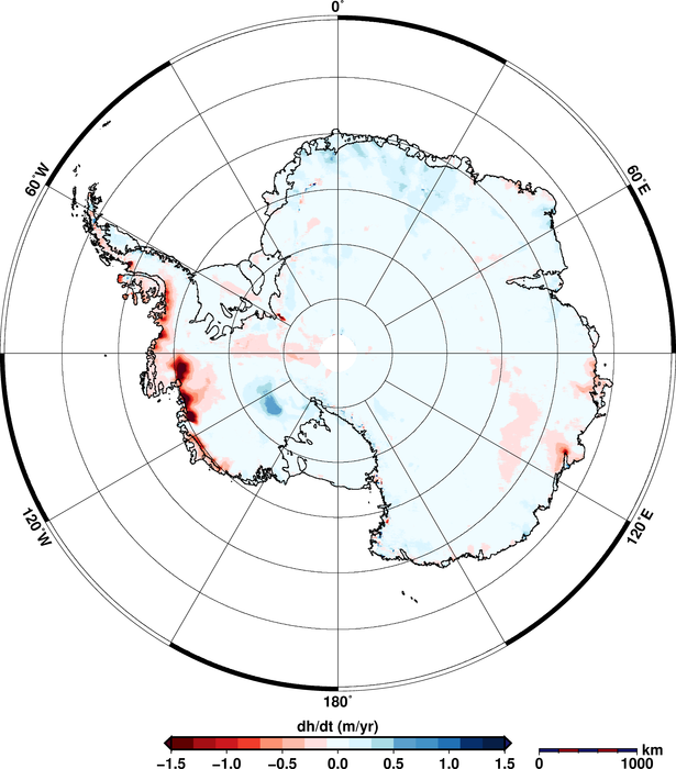
Antarctic ice-sheet change
The two ice sheets combined are thinning at a rate of 500 cubic kilometres a year, the highest rate observed since altimetry satellite records began about 20 years ago.
The researchers say the ice sheets’ annual contribution to sea-level rise has doubled since 2009.
Glaciologist Angelika Humbert, another of the study’s authors, added, “Since 2009, the volume loss in Greenland has increased by a factor of about two and the West Antarctic Ice Sheet by a factor of three.
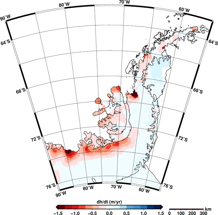
Both the West Antarctic Ice Sheet and the Antarctic Peninsula, in the far west, are rapidly losing volume. By contrast, East Antarctica is gaining volume, though at a moderate rate that doesn’t compensate for the losses on the other side of the continent.”