https://link.springer.com/article/10.1007/s00382-014-2155-z
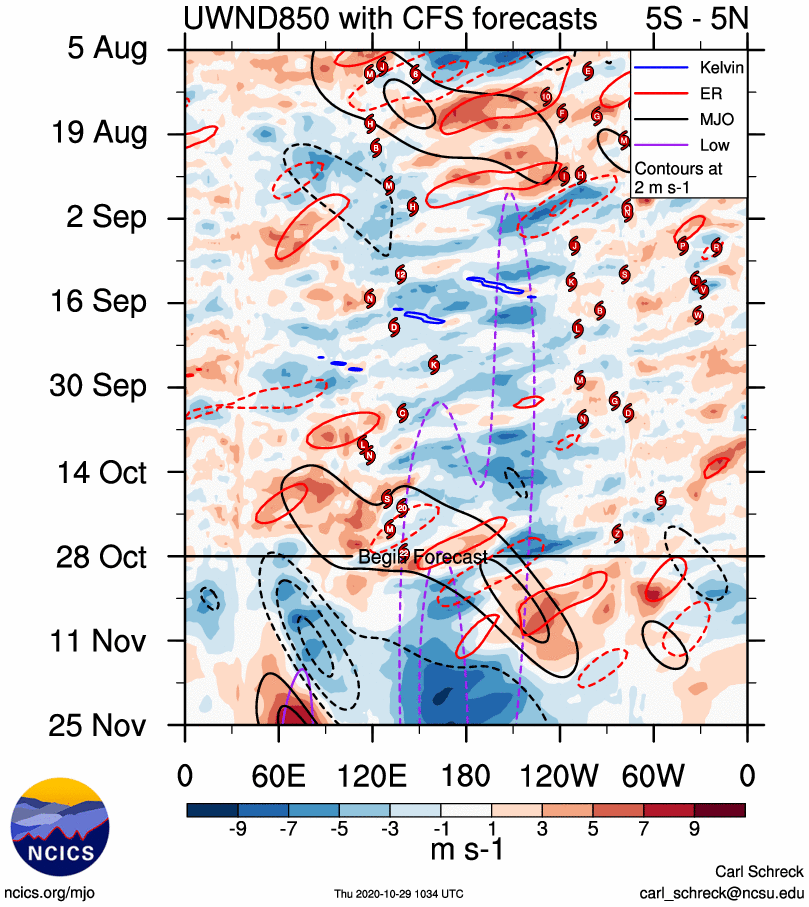
Momenteel zitten we in een EP La Niña winter. Blijft dat zo? Afwachten. Verwachting is dat na korte onderbreking door de MJO, de oostelijke winden opsteken (blauwe kleuren) die afkoeling van het zeewater brengen naar het westen.
Uit genoemd artikel.
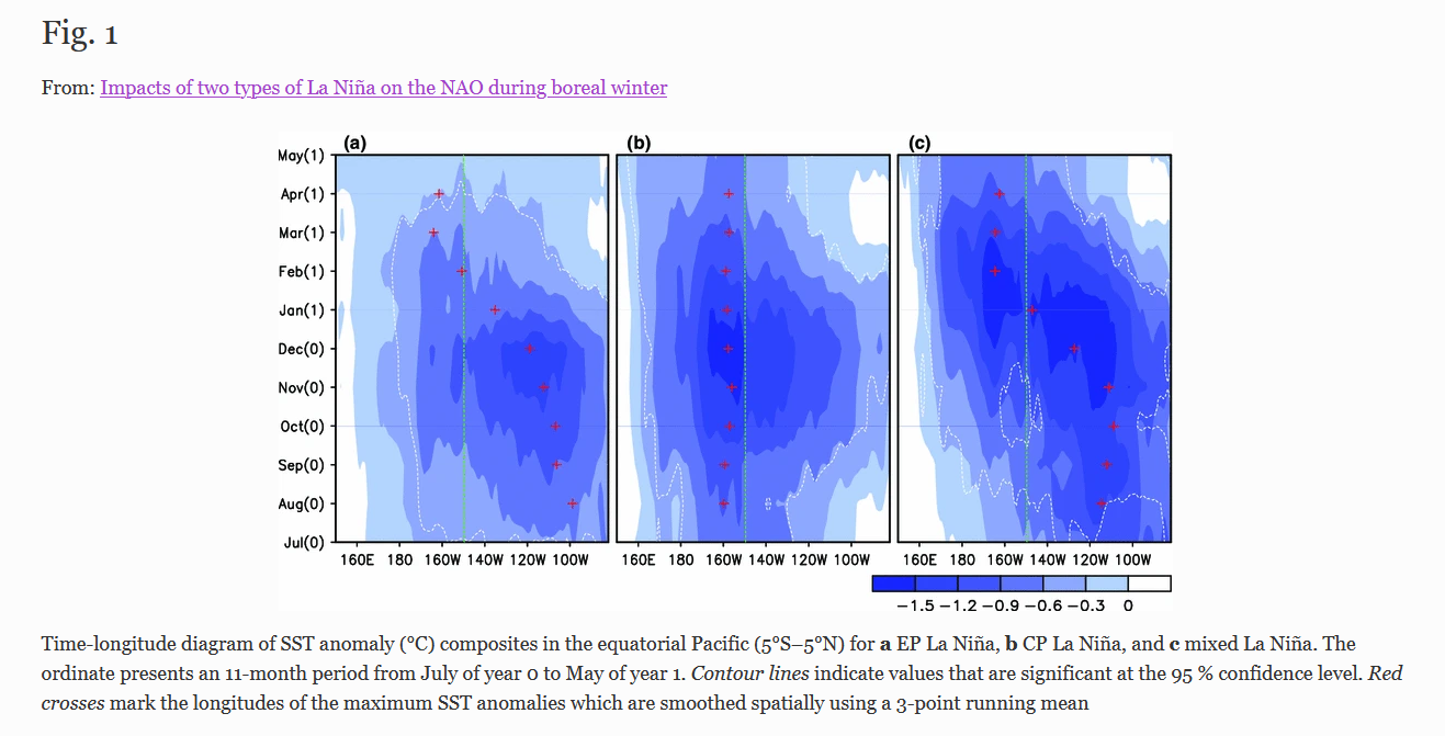
Then we identify seven EP La Niña winters (1954/55, 1955/56, 1964/65, 1971/72, 1984/85, 1995/96, and 2005/06) and seven CP La Niña winters (1973/74, 1974/75, 1975/76, 1983/84, 1988/89, 1998/99, and 2000/01). The winters, having larger SST anomaly in the EP (CP) east (west) of 150°W during the developing and mature phases of La Niña, are classified into the EP (CP) La Niña winters. The longitude of 150°W is selected because it is a boundary of Niño3 (5°S–5°N, 150°–90°W) and Niño4 (5°S–5°N, 160°E–150°W) areas, which are usually used to define the two-type ENSO events (e.g., Kim et al. 2009; Kug et al. 2009). Other three years (1970/71, 1999/00, and 2007/08) are defined as the mixed type of La Niña, because the large cooling SST anomaly covers both the EP and CP during the mature phase.
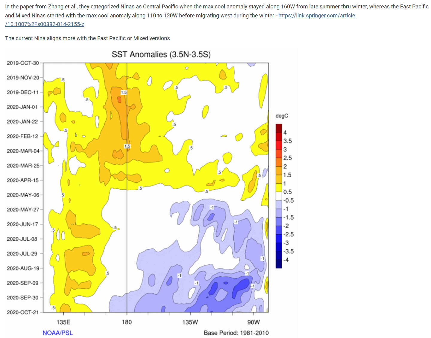
Je ziet hier de drie types. EB, CB en mixed La Niña. Daarbij de huidige situatie.