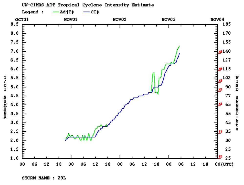
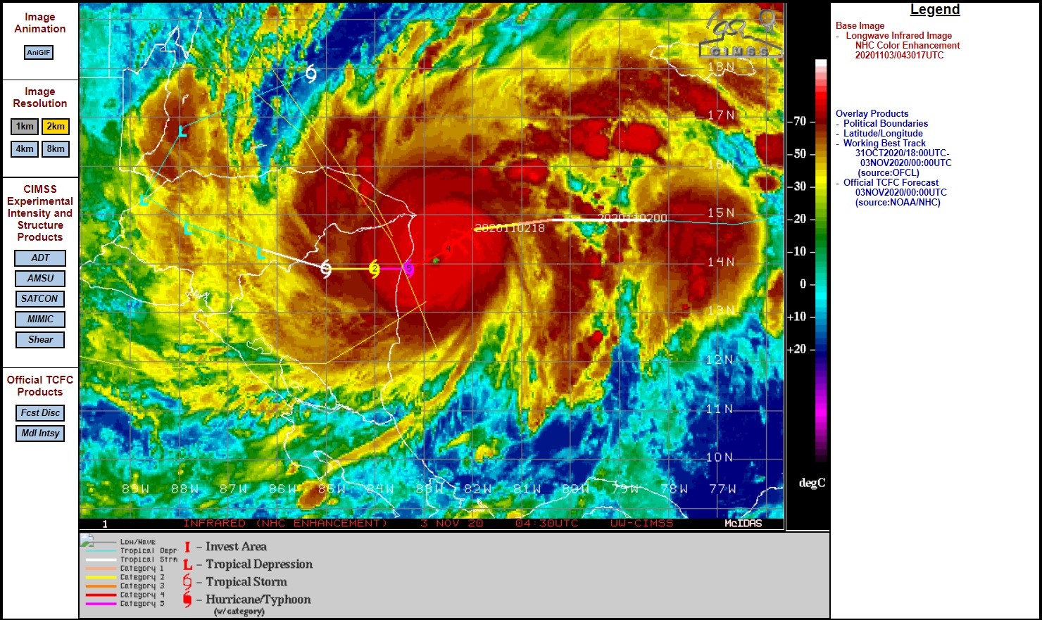
De snelle aansterking is gestopt en hij komt nu ook zo dicht bij land dat dit een rol gaat spelen.
000
WTNT44 KNHC 030854
TCDAT4

Hurricane Eta Discussion Number  11
NWS National Hurricane Center Miami FL       AL292020
400 AM EST Tue Nov 03 2020

Eta remains an extremely well-organized hurricane with a distinct
eye embedded within cloud tops colder than -80C.  Based on
continuity from the earlier Hurricane Hunter observations and
Dvorak classifications from TAFB and SAB, the current intensity
estimate remains 130 kt.  Images from the San Andres radar show
at least one concentric eyewall, and this structure has likely
stopped the rapid deepening process.  Nonetheless, Eta is an
extremely severe hurricane, capable of causing very high storm
surges and catastrophic damage.
https://www.nhc.noaa.gov/text/refresh/MIATCDAT4+shtml/030854.shtml