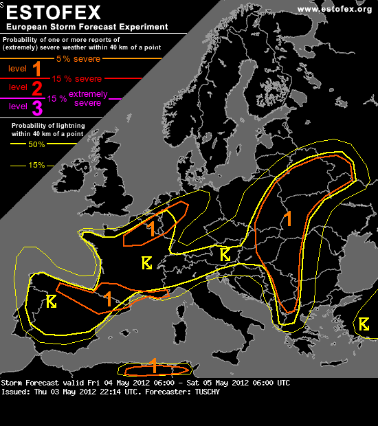
A level 1 was issued for parts of NE France, Belgium, Luxembourg and far W/NW-Germany mainly for isolated large hail and strong wind gusts.
... France, Belgium, Luxembourg and NW-Germany ...
Downstream of an upper low atop the Bay of Biscay, some BL moisture recovery occurs over France beneath cool mid-levels. Right now, best LL moisture probably will be found along and just south of a stationary front, which is situated over N-France. A weak occlusion also approaches from the west during the daytime hours and assists in somewhat enhanced LL moisture advection. Therefore a level 1 was issued for that area, as 15 m/s DLS overlap with modest MLAPE of 500-800 J/kg. Strong wind gusts and isolated large hail are forecast. Sideward MCS storm motion vectors forecast along that boundary with 700 hPa winds increasing to 20 m/s over far W/NW Germany point to an augmented chance for small eastward moving lines of thunderstorms with a locally enhanced strong wind gust risk. Therefore the level 1 was expanded all the way to NW Germany, despite decreasing CAPE. Storms gradually decay after sunset.
Bron: http://www.estofex.org/cgi-bin/polygon/showforecast.cgi?text=yes&fcstfile=2012050506_201205032214_1_stormforecast.xml