Estofex: Level 2 voor Z-Frankrijk en NW-Italie (veel regen)
Bericht van: Saskia (Diepenveen) - moderator - , 10-11-2012 11:54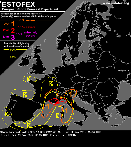
Storm Forecast
Valid: Sat 10 Nov 2012 06:00 to Sun 11 Nov 2012 06:00 UTC
Issued: Fri 09 Nov 2012 22:05
Forecaster: TUSCHY
A level 2 was issued for SE France and parts of NW Italy mainly for excessive rainfall amounts.
A level 1 surrounds the level 2 area mainly for heavy rain (onshore) and isolated large hail, a few tornado and severe wind gust reports (offshore/along the coasts).
A level 1 was issued for the Balearic Islands mainly for heavy rainfall.
SYNOPSIS
The major long-wave trough and the dissolving cut-off over Spain will merge over W-Europe with a far south deepening trough being the final result. Geopotential height increase continues over S/C Europe with a cut-off process over far SE Europe. This means unsettled conditions for the W/C Mediterranean with numerous showers and thunderstorms.
Bron (en volledige bericht): http://www.estofex.org/cgi-bin/polygon/showforecast.cgi?text=yes&fcstfile=2012111106_201211092205_2_stormforecast.xml
Bericht laatst bijgewerkt: 10-11-2012 11:55